![International Space Station (ISS) Camera's Capture Views Of Hurricane Matthew [Unedited] YT image](https://space-streams.com/wp-content/uploads/2025/10/space-station-storm-mathew-yt.png)
🌍 The International Space Station (ISS) is humanity’s most ambitious and enduring outpost in space, a marvel of engineering, diplomacy, and scientific exploration. Orbiting Earth at an altitude of about 420 kilometres, the ISS serves as a microgravity laboratory, a test bed for future space missions, and a symbol of international cooperation.
Launched in 1998, the ISS was assembled piece by piece in orbit.
Built through collaboration among NASA (USA), Roscosmos (Russia), ESA (Europe), JAXA (Japan), and CSA (Canada).
Composed of pressurized modules for crew and research, solar arrays for power, and external trusses for structural support.
Key modules include:
- Zarya (Russian power module)
- Unity and Destiny (American lab modules)
- Columbus (European lab)
- Kibō (Japanese lab)
- Zvezda (Russian service module)
👩🔬 Scientific Purpose
The ISS is a unique research platform where scientists study phenomena impossible to replicate on Earth:
- Human physiology in microgravity (e.g., bone density, muscle atrophy)
- Fluid dynamics, combustion, and materials science
- Biological experiments, including plant growth and microbial behaviour.
It also supports Earth observation, space weather monitoring, and technology testing for missions to the Moon and Mars.
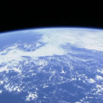
Hurricane Matthew:
Hurricane Matthew, a powerful and devastating storm, was closely monitored by various satellites and cameras, including those aboard the International Space Station (ISS). The ISS, orbiting approximately 400 kilometres above Earth, provides a unique vantage point for observing weather phenomena. Its cameras captured stunning and detailed images of Hurricane Matthew as it churned through the Atlantic Ocean, offering invaluable data and insights into the storm’s behaviour and impact.
The ISS’s high-resolution cameras and advanced imaging technology allow scientists to observe and analyse hurricanes in real-time. These images reveal the intricate structure of the storm, including the eye, eyewall, and spiral rain bands. By studying these features, meteorologists can better understand the dynamics of hurricanes and improve their forecasting models.
During Hurricane Matthew, the ISS cameras captured the storm’s progression from a tropical storm to a Category 5 hurricane. The images showed the storm’s massive size, with cloud bands stretching hundreds of kilometres across. The eye of the hurricane, a calm, and clear area at the centre, was clearly visible, surrounded by intense thunderstorms and high winds.
The data collected by the ISS cameras is crucial for disaster preparedness and response. By providing real-time information on the storm’s location, intensity, and movement, these images help authorities make informed decisions about evacuations, resource allocation, and emergency response efforts. Additionally, the visual documentation of the storm’s impact on coastal areas and infrastructure aids in assessing damage and planning for recovery.
The ISS’s ability to capture detailed views of hurricanes like Matthew underscores the importance of space-based observation systems in modern meteorology. These systems complement ground-based radar and satellite imagery, providing a comprehensive picture of weather events. As technology continues to advance, the role of space-based cameras in monitoring and understanding hurricanes will only become more significant, enhancing our ability to protect lives and property from these powerful natural disasters.
🔔 Subscribe and turn on notifications to explore the cosmos with us, one stream at a time!.
#internationalspacestation #iss #apollo #esa #hubble #jwst #earthview #relaxing
 Click Here To Visit Our YouTube Live Stream
Related posts:
 Space Chat Podcast Topics
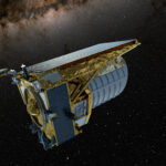 Euclid wide-angle space telescope
 NASA Progresses Toward Artemis II Moon Mission
 Hubble Seeks Clusters in ‘Lost Galaxy’
 Space Chat Podcast
 Space Streams Documentaries YouTube Live Stream
 Vera Rubin Telescope
 Artemis II
 Gemini North telescope
 3I/ATLAS
 How to disable XP participation on YouTube chat
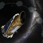 Kepler Space Telescope
 Space Streams – Documentaries + Space Chat
 International Space Station (ISS) Camera’s Capture Views Of Hurricane Matthew [Unedited] Live Stream
 Space Streams – Observing Earth [Ambient] Live Stream
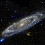 Andromeda Galaxy
![Space Streams - Nebula [Ambient] image](https://space-streams.com/wp-content/uploads/2024/11/space-streams-nebula-150x150.png) Space Streams – Nebula [Ambient] YouTube Live Stream
Space Streams – Nebula [Ambient] YouTube Live Stream
 Schumann resonances
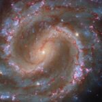
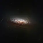
 NGC 3627
 Sombrero Galaxy M104
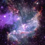
 Rosette Nebula: The Heart of a Rose
 NASA Releases Hubble Image Taken in New Pointing Mode
 A Virgo cluster galaxy
 NGC 346
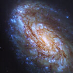
 NGC 1672
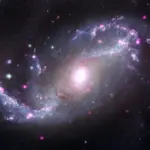
 Christmas Tree Galaxy Cluster
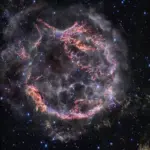 Cassiopeia A (NIRCam)
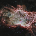
 Top of the Horsehead Nebula
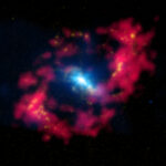 NGC 4151: An Active Black Hole in the “Eye of Sauron”
 Chandra telescope star cluster insight
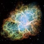 PIA03606: Most Detailed Image of the Crab Nebula
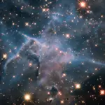 Mystic Mountain in Infrared
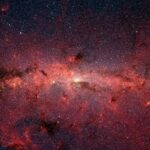 The Milky Way
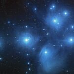 Pleiades
 Posts
Posts
 Hubble Space Telescope
 Chandra X-ray Observatory
 Contact us
 Space Streams